Prof. Dietrich Neumann has sent a one-and-a-half-hour video of his Brown University students describing Jewelry District buildings at an event on April 24, and which I featured on this blog, which I now repost. The students’ presentations are excellent, as I said then, but I was unable to describe them individually, so here they are. I have embedded the video in the original post linked to this reblog. Enjoy!
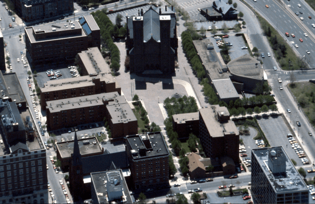 Aerial view of Cathedral Square shows many entry points into the plaza. (Digital Commons @ RIC)
Over the course of four days the Providence Preservation Society hosted two events, one about Cathedral Square, which I’ll discuss first, and the other about the Jewelry District.
The first event, held at the Department of Planning and Development’s offices last Friday evening, featured a panel on Cathedral Square, part of the Weybosset Hill segment of the Downtown Providence 1970 plan (announced in 1960) and one of the blessedly few parts of that plan that was realized. Before the site was razed, it was an active part of town where Westminster and Weybosset met at the far end of the “bow” originating near the Provi- dence River. A panel including Boston planner Tim Love and landscape historian Charles Birnbaum described how Cathedral Square came to be but had little to say regarding why it…
View original post 496 more words